
Written by Jenny Woods
To most I imagine Iceland needs little introduction. Found on the mid-Atlantic ridge above a hot spot, dominated by volcanic processes as tectonic plates diverge, it is a land of geological extremes. My first encounter with its wonders was just over a year ago, when began what I hope will be a long love affair with the chilly and remote, northern country. Quite remarkably I found myself travelling to the capital Reykjavik to meet the Cambridge volcano seismologists before I even began postgrad research and before, in fact, I had actually studied any earth sciences at all (being from a physics background). Needless to say it has been a rapid learning curve.
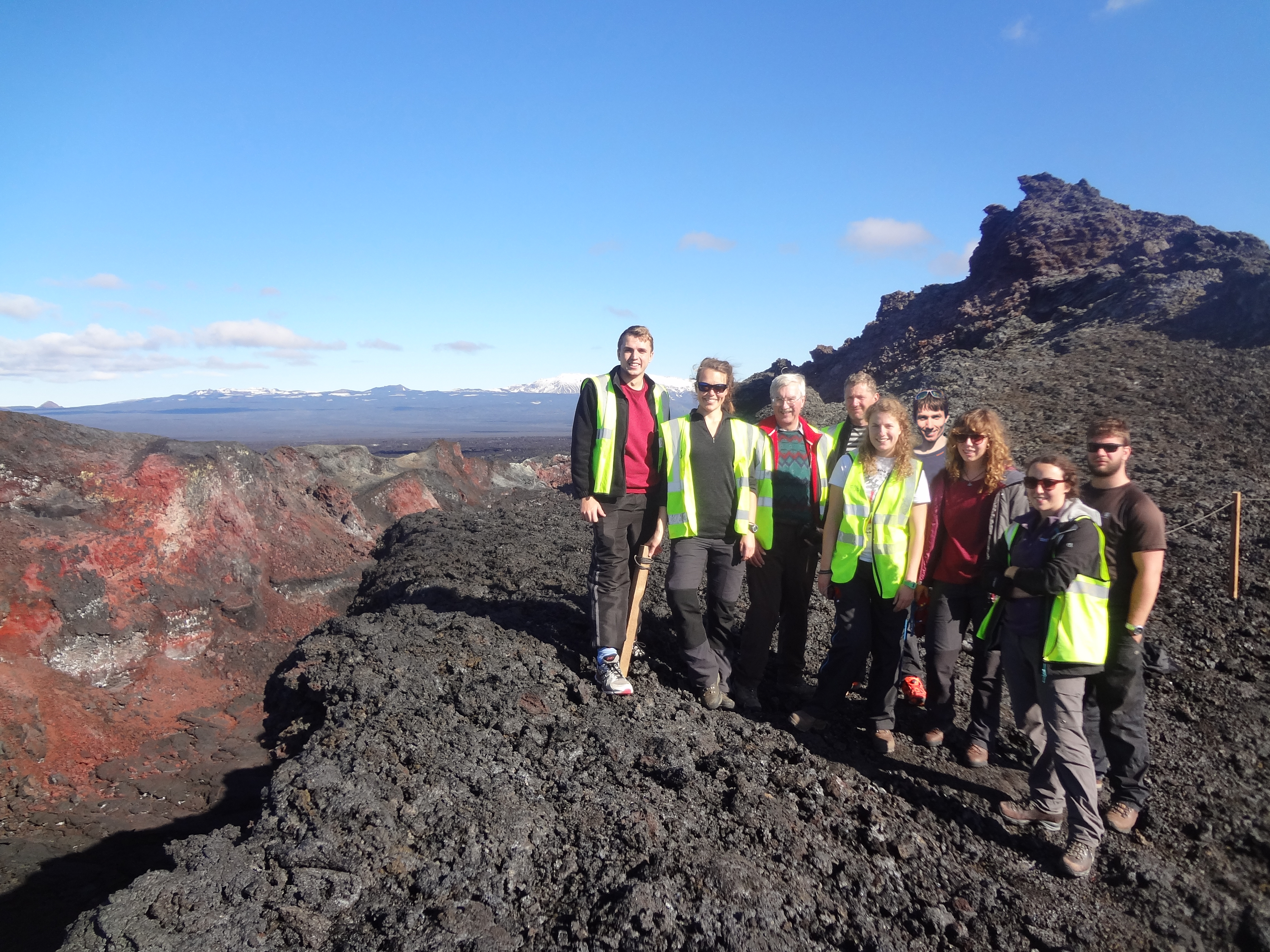
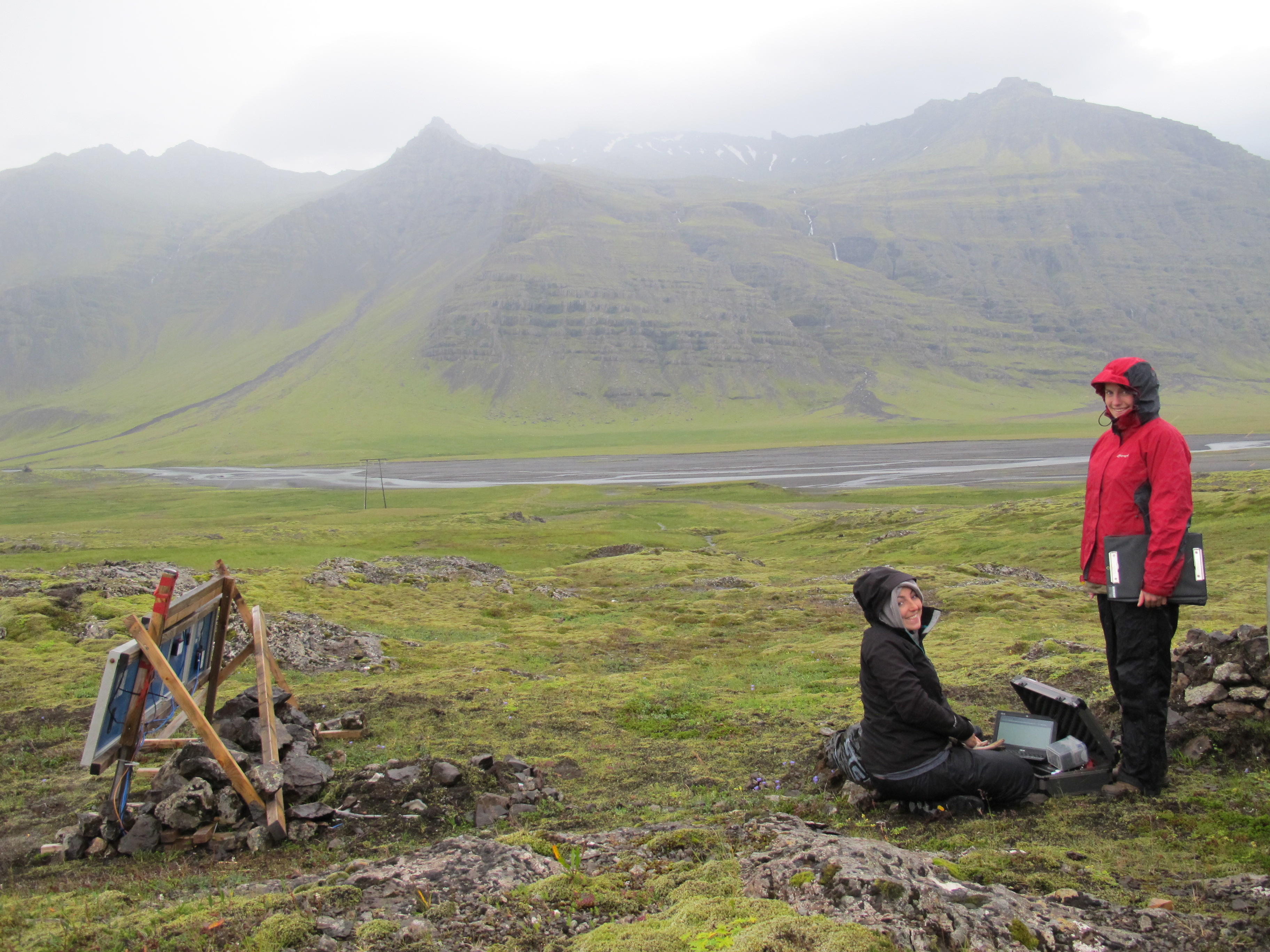
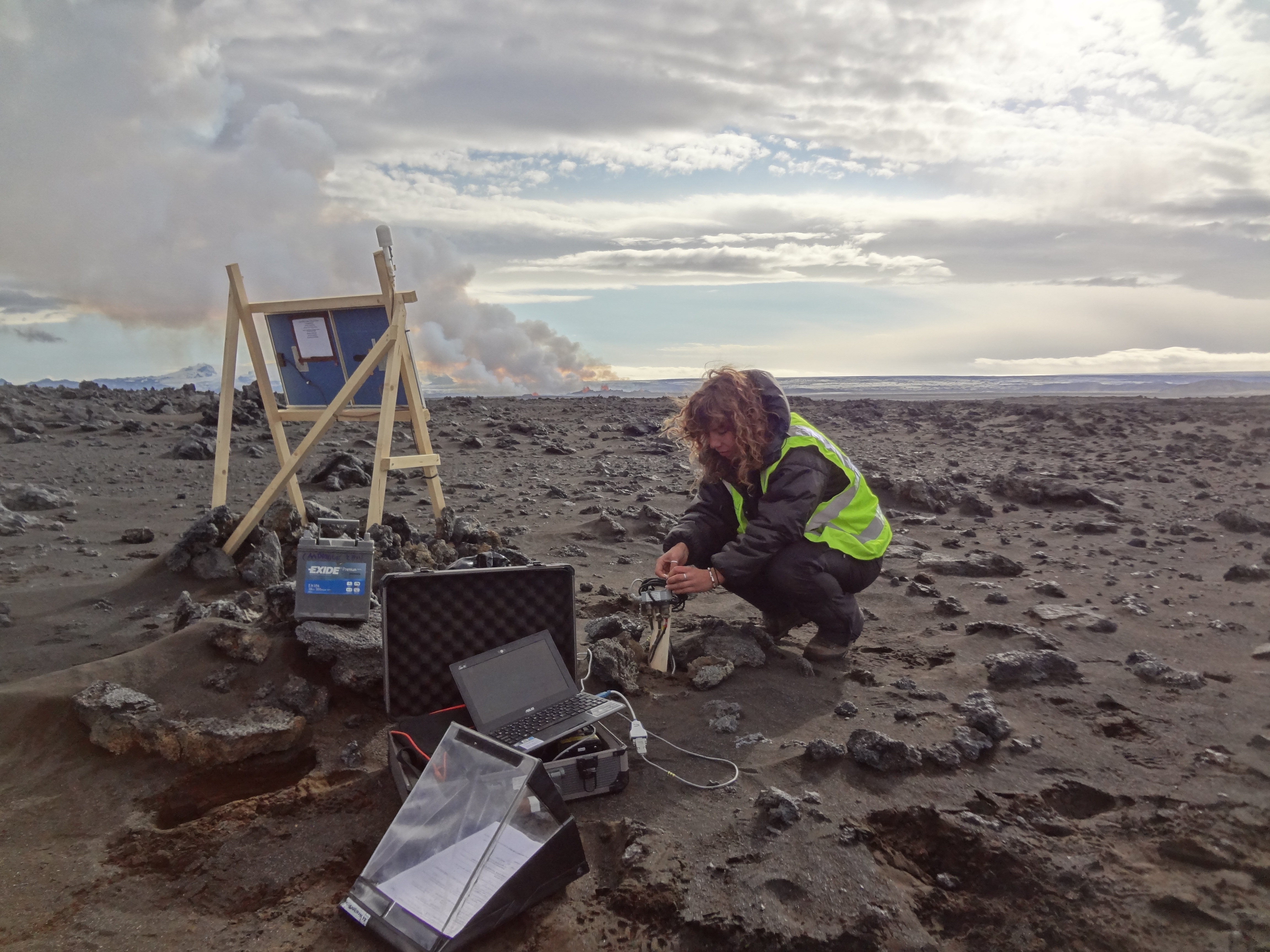
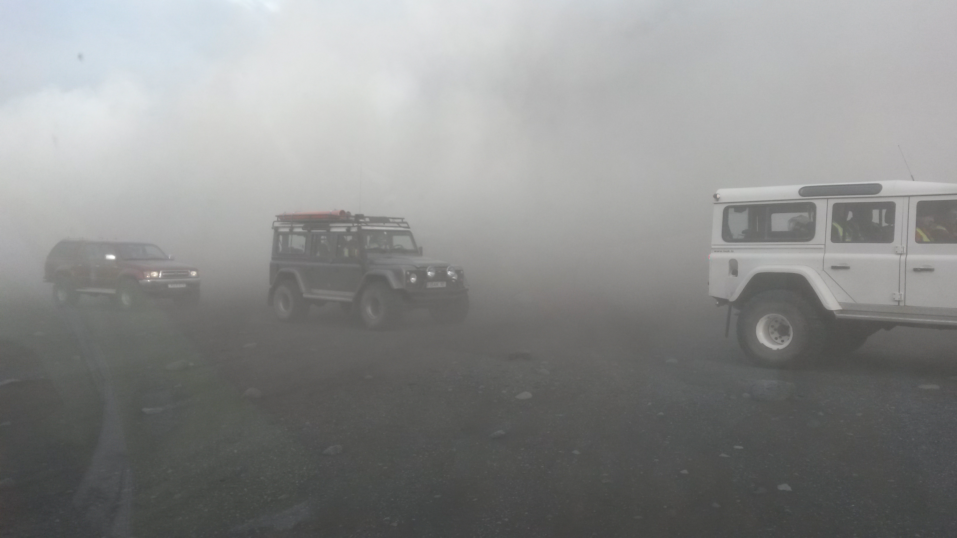
The Cambridge network of seismic instruments in Iceland, established by Bob White and his group, stretches acoss the whole country and is serviced twice a year by (willing) volunteers. Servicing involves visiting each and every instrument, downloading the recorded data and checking the (solar-charged) power, connections and GPS etc are in good working condition. Limited daylight, high winds and sandstorms, snow and ice or relentless rain, all present quite a challenging environment to run a network, but the data collected provides no end of insights into the structures and processes at play beneath the surface.
Click here to watch deployment, testing and retrieving of a seismometer
And so in August 2014 I set off with the group into the central highlands where most of the instruments are located. It was by no means a ‘typical’ trip, since for starters the weather was being unusually kind to us. Crucially though, the prior weeks had seen onset of unrest in the subglacial volcano Bardarbunga which had quickly developed into a lateral injection of magma known as a dyke propagating directly toward the centre of our network. Amidst the volcanic alerts and ‘jökulhlaup’ glacial flood warnings we commenced servicing (access only for scientific research!), and took the opportunity to install additional, optimally-placed instruments to better record the seismicity associated with the dyke propagation. Just one day in, and shortly before my 2 AM ‘check for northern lights’ alarm, we were woken by reasonably violent shaking. With the knowledge that an underground channel of molten rock was heading towards us, and that being towards the foot of the huge volcano Askja, we were understandably uneasy. By 3 AM the Icelandic Met Office (IMO) confirmed that the hypocenter of the ‘quake was in the Askja caldera, just 2-3 kilometers away, and had been magnitude 4.5, which prompted us to pack up ready to leave at short notice. Reports came in of cracks on the glaciar, suggestive of subglacial eruption or at least increased heating. All the while we continued with our work but remained on guard, keeping an eye on the northerly advance of the dyke, which appeared to have stalled.
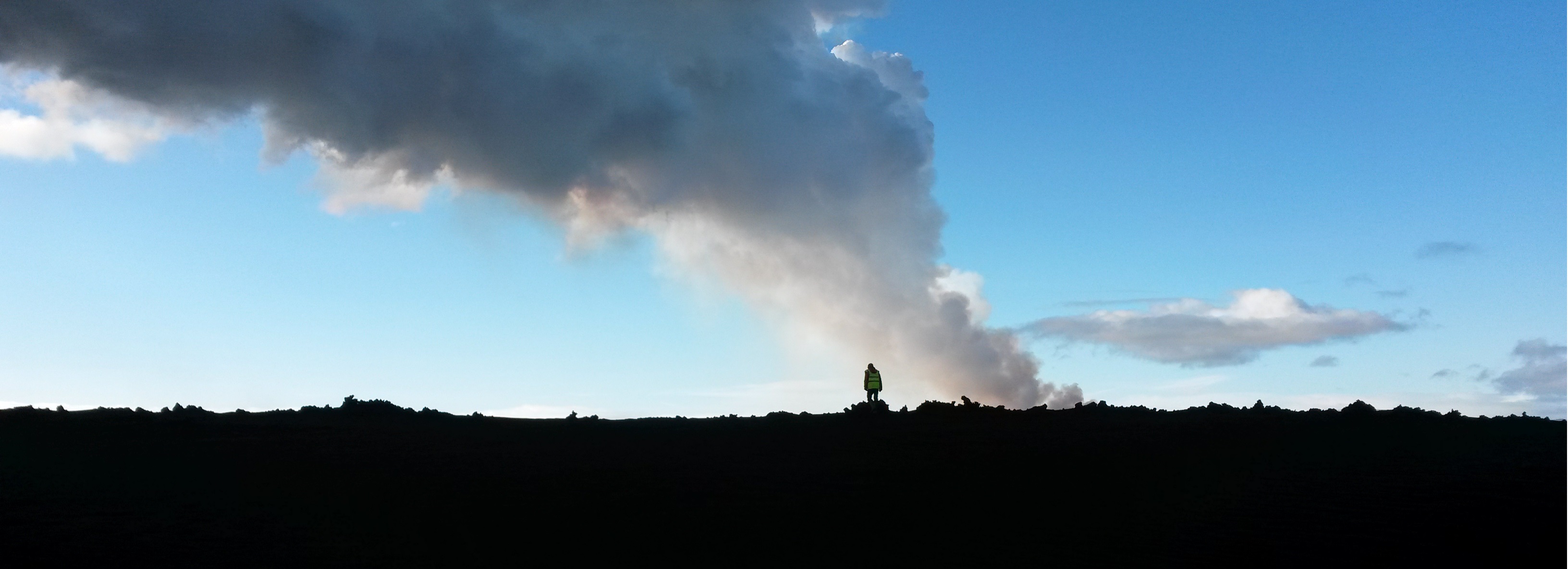
Just after midnight on August 29th, the IMO spotted activity on a webcam overlooking the old Holuhraun lava field, and quickly radioed us (as the only group in the field). We hurried out to investigate and found the dyke had ruptured the surface; between Vatnajökull glacier to the south and Askja volcano to north, and beneath the northern lights, there was a curtain of fire. We got as close as we dared and watched as the spouting lava first grew and intensified, then gradually waned, and by morning just a steaming fissure remained. Servicing resumed but over the next day or two more and more scientists joined us at the hut, from university volcanologists and geochemists to the IMO team (hazard monitoring). Then, at 6 AM on August 31st, the IMO alerted us to a second suspected eruption. The whole hut bundled into cars and rushed to the Holuhraun lava field where the fissure was indeed erupting again, extending further and higher this time and showing no signs of abating. Sand storms were closing in though, and forced us to leave. In the following days the eruption strengthened as dominant lava fountains and craters became established. The spectacular Bardarbunga-Holuhraun eruption fissure:
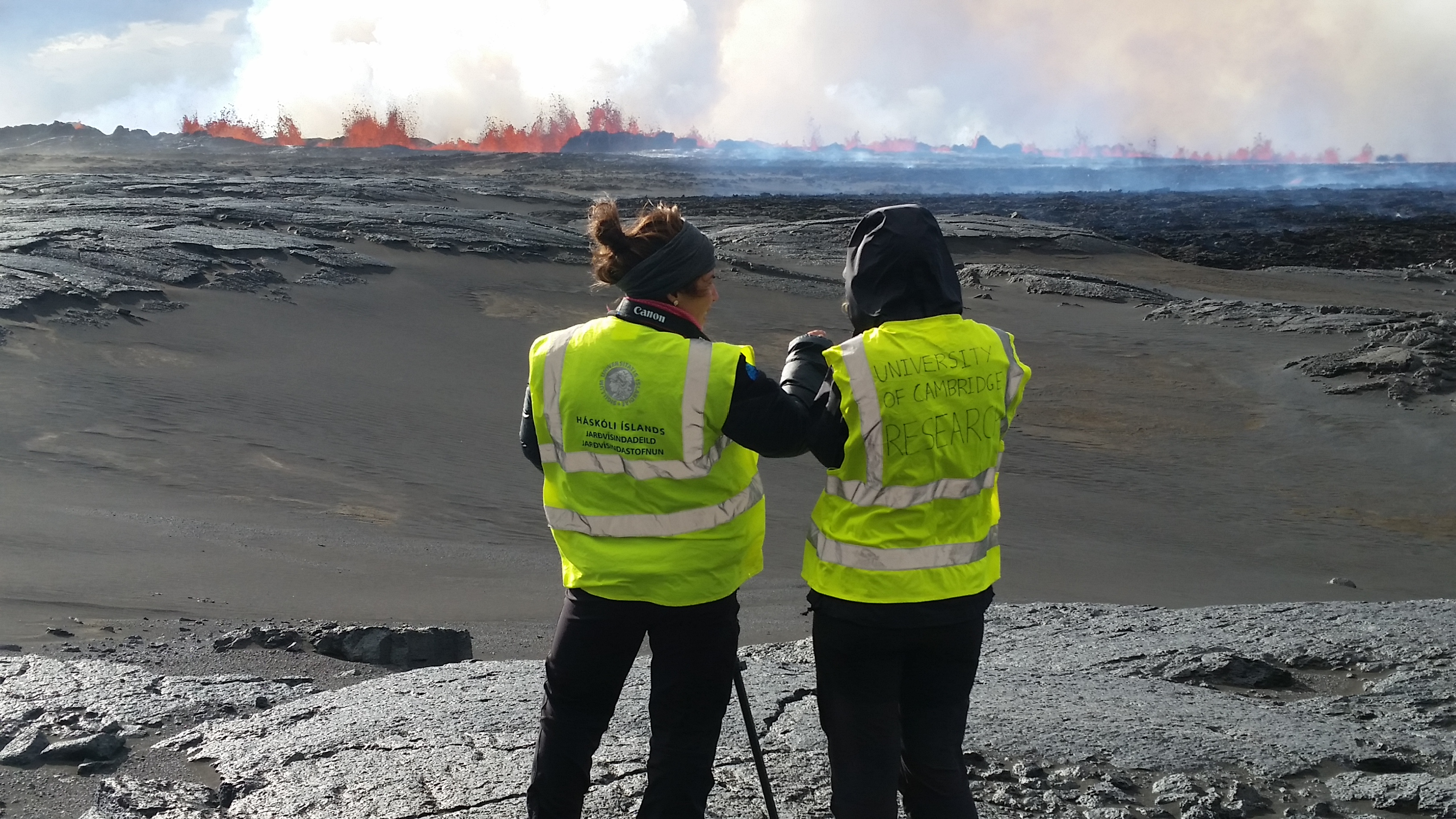
Servicing now involved checking our instruments hadn’t been overrun by the advancing fresh lava field, and of course a substantial amount of admiring the view..day and night we returned to watch the eruption in all its glory. Advancing lava by night:
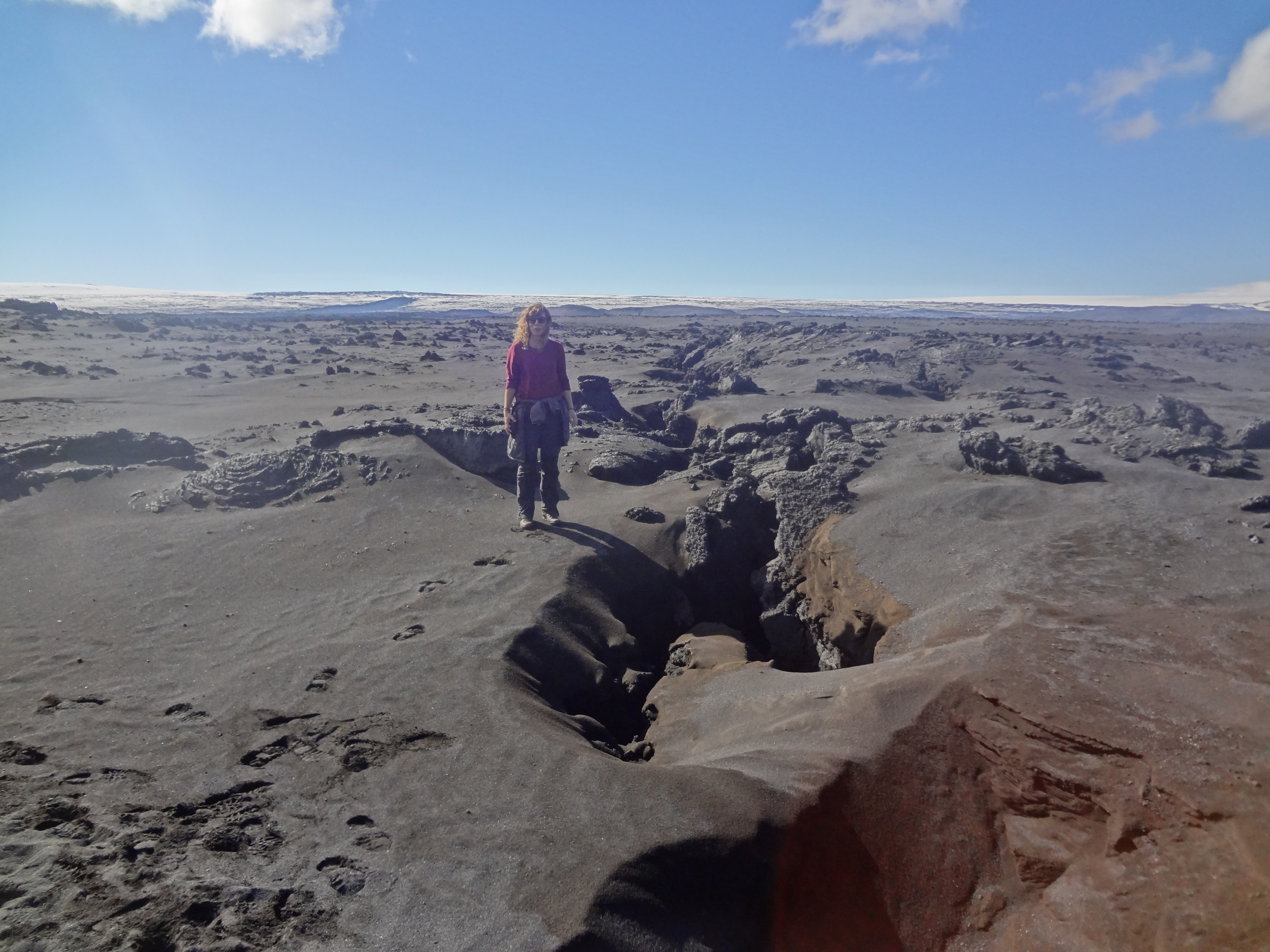
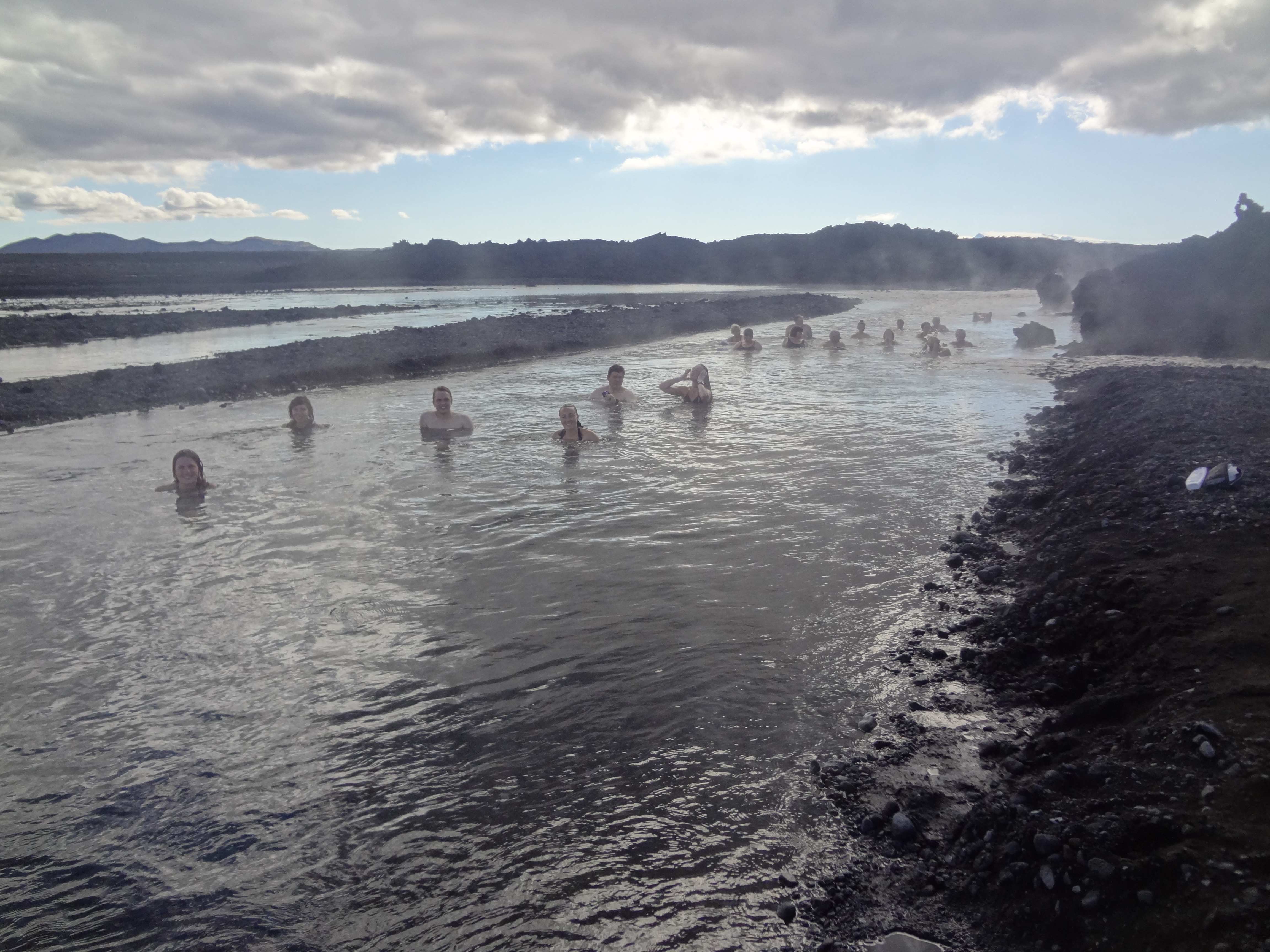
Media attention grew; others in the group were interviewed for Icelandic TV and the BBC, and twitter activity rapidly escalated. The main concern now was that the sustained eruption, while it somewhat calmed fears of other potential eruption scenarios, was emitting persistently high levels of sulphur dioxide gas reaching as far as Norway and Sweden. Gas and ash sensors were brought in, as the advancing lava on meeting the glacial outflow river was producing a huge plume. Unfortunately, we only have a finite number of instruments in the Askja area, and despite each one requiring long drives or hikes over awkward lava fields we reached the end of our fieldwork jobs in the central highlands. After a last visit to the eruption site we packed up and left. At this point the group split; one car headed east and south, one west of Vatnajökull glacier, and one northwards, to service the instruments across the rest of the country. I went with the team down the west side of Vatnajökull, to the foot of Bardarbunga volcano where the dyke began its 46 km journey. Here we spent a few days deploying some additional instruments and servicing those already in situ., before making our way back to Reykjavik. Our fieldwork was complete, for 2014 at least, and we returned to Cambridge to begin examining the data and to monitor the progress of the eruption from behind our computer screens. It wasn’t until 6 months later that it was declared officially over, having produced the biggest lava field in over 250 years and built up some impressive craters. Now, as we tried and tested on our return this summer, one can bath in the heated glacial stream that flows beneath the still-hot lava field. It will likely be more than tens of years before it has cooled.
Check out more videos on our youtube channel here!